So it’s possible that this fire could still be burning when we’re up there for the trip, although they’re calling it 30% contained right now and they got between a half and one inch of rain yesterday. It sounds like that helps with the pine needles and small stuff but the big logs will keep burning through that kind of rain. And there was lots of lightening as well so they’re concerned about other fires being started from that.
The Forest Service seems comfortable with the amount of control they have over the situation, but they keep saying that depending on conditions it could be fall before the thing goes out completely.
If the fire is still burning in mid August it’s possible (but unlikely) that they won’t allow us to enter the BWCA at all, it’s probable that they’ll restrict where we go and I’m assuming that we won’t be allowed to have campfires under any circumstances.
I’m willing to bet it will be out by mid August and there won’t be much in the way of restrictions. If the fire is out I wanted to suggest the possibility of going to see some of the burned areas. I’m not advocating this, just pointing it out as an option.
We’d probably have to go up to Little Saganaga and maybe take a day trip to the northeast from there to really get into the middle of where the fire is right now. We would have to cover more ground to get up there but it wouldn’t be especially difficult to do in the amount of time we have planned.
We don’t have to decide any of this now or really until probably August 14th but I thought it might be good for us to give it a little thought.
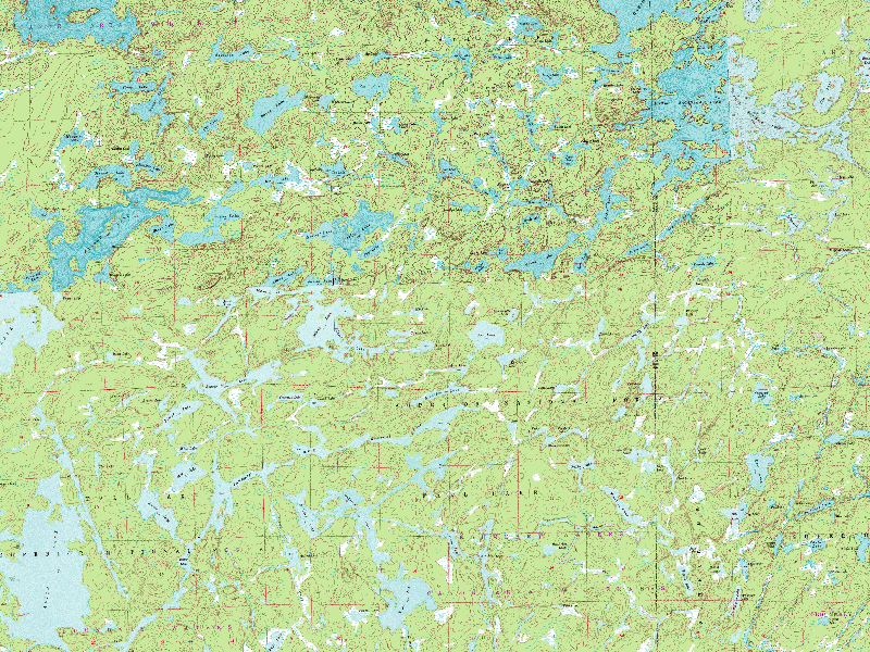
So this crappy map can give an idea of where things are but you can’t see much detail.
Our start point is a couple miles south of the bottom center of this map. The original plan was to go west and spend time on the big lakes along the left side of the map. If we decide to go see the fire we’d need to go to the upper right corner of this map, the big lake up there is Little Saganga.
No comments:
Post a Comment