Thursday, September 28, 2006

OK, Pete has asked for more pictures.


I'll put on one of the carburetor on after I get back from the football game.
Go Hawks!
Old projects:

New projects:

Wednesday, September 27, 2006

So here's the quick version of the rest of the trip.
Went to Tomsonite beach, showered.
Went to Naniboujou for dinner, Henry threw 4337 rocks into lake Superior while we waited.
Went back and slept at Tomsonite beach.
Got up the next day, went to Grand Marais. Had donuts, went to Sivertson's etc...
Drove up to our property, everyone agreed that it was a dump with a nice view. Had a cookout and camped there that night.
I accidently scared the crap out of Henry that night while he was in the tent, hopefully he won't be scarred for life.
The next day we got up and drove back to Minneapolis with a quick stop at Gooseberry falls to see the sights.
We had some chocolate cake from the 50's Grill. Henry learned how to get people with the squirt bottle:

The next day everyone went home.
That's what we did on our summer vacation.
The end.

Tuesday, September 26, 2006

Thursday, day five.
So this was our last morning and another short travel day so I was planning on sleeping in. I woke up at dawn and was feeling very comfortable and relaxed in my sleeping bag. Just as I was dozing off there was a rumble of thunder in the distance. Then I started worrying about the food and equipment packs getting all wet and was unable to go back to sleep. I decided I'd go out quick and gather everything up and put it under the tarp so it would stay dry. And then I could get back in the tent and sleep until the storm blew over. Just then it started sprinkling so I decided I better hurry. Running out in my underwear I started grabbing stuff and throwing it under the tarp, the mosquitoes had not decided to sleep in and were happily searching for places to bite that I couldn't reach. Soon I was back in the tent only slightly damp and moderately bitten up. I got back in my sleeping bag and was just getting my heart rate slowed down when I heard Rob and Carrie moving around in their tent. Pretty soon it became apparent that they were packing up. I told them to go back to sleep but they were having none of it. So rather than sleeping in we started packing up our stuff too.

We ate our oatmeal under the tarp trying to stay out of the light rain. Soon we were packed up and heading east toward the portage, the rain stopped before we started the portage. The air was warm and incredibly humid as we started hiking, throw in all the water dripping off the trees and brush and a few dozen mosquitoes and it was kind of unpleasant. But after a portage or two the wind started picking up and that helped a lot, it was still warm though. We had a 300 rod portage for a warm up and then the 480 from Zenith down to Lujenida Lake, it's a killer no matter what the conditions.

There's nothing worse (on a canoe trip) than carrying a canoe while hot, tired, uncomfortable with about 12 mosquitoes buzzing your arms, head and neck and knowing that you still have 20 minutes or so before you get to the end of the portage. At one point Rob stumbled and almost fell, that probably would have been worse… Even Lucy was having a hard time with her pack, it was heavier on one side than the other so it was hanging crooked. Every once in a while she'd stop and give me a look but I was just as irritated so she eventually stopped to wait for Sandy, maybe hoping that she'd fix it.

By the time we got to Lujenida the sun was coming out and there was a nice breeze and all the frustration was immediately forgotten. We stopped to look at the "Viking dolmen" which Rob and Carrie seemed unimpressed by. As we left Rob and Carrie managed to get their canoe stuck on a rock he got a little testy while trying to get them unstuck, Carrie just said "serenity now" and ignored him. Here's a picture of Rob trying to peel out to get them off the rock.


As we cruised down Kelso there were suddenly people everywhere, we must've seen five or six groups on Kelso alone. With the wind coming out of the south Alton was kind of rough which seemed to make Rob and Carrie a little edgy but once we got across to the east side of the lake it was a little more sheltered. We pulled into the portage and decided to have one last wilderness meal so we parked all our stuff and hiked up to the big rock next to the Alton side of the portage.

It was a very leisurely lunch, we had to finish off the Skittles, Peanut M&Ms and jerky among other things. We were entertained by 3 people in pith helmets paddling around near the portage. It seemed that they were nervous about the wind and waves out past the peninsula that protects the portage so they just went back and forth randomly. It doesn't sound that amusing now, maybe we had been away from civilization too long.…

Anyway, we portaged across to Sawbill and fought the wind all the way down to the landing then made the last portage up to the store. Where we found Betsy and Pete in the bathroom changing Henry's diaper.

They had just picked up my car from Kawishiwi and transported it to Sawbill and were getting ready to go out for Henry's first canoe paddle. We sent them out on their adventure and unpacked our stuff, took the obligatory end of trip picture and then headed down to Thomsonite Beach to take some showers.

Monday, September 25, 2006

Wednesday, day four.
This was going to be a little longer day so we were a bit more businesslike in the morning, plus we had developed something of a system by this point. We ate our oatmeal and got packed up and on the water relatively quickly. At some point during the packing up the twin engine airplane showed up doing it's twice hourly fly-by. Just before we left we decided to do one more team photo.

As we paddled down the long southeast arm of Little Sag we went past an island that had a bunch (like 20) of new latrines stacked up in plain sight on the shore. They were a new style, still fiberglass but boxier than the old ones. We were kind of irritated that they left them laying out in the open like that, it always used to be that they'd hide stuff like that back in the woods until they were ready to use it.

There was fire damage all along the left hand shore, but it was a bit more spotty than it had been in the northeast corner of the lake. There were lots of cedars along the shoreline that had been spared. On the portage we couldn't really see any signs of the fire but once were out on Mora (the next lake) we could see it again. It was spotty but you could see significant pockets of damage all along the northern parts of the lake.

We turned south here heading for Mesaba and away from the fire zone, although we could still see that plane circling the fire for a few more lakes.

The weather was great all day and we were making good time so we didn't stop to eat lunch until we got to our site on Mesaba. There aren't any great sites on this lake, we stayed in the center one. Rob and Carrie went swimming again, I can't remember if Sandy went or not. I took a nice nap in Rob's hammock. Later Rob conked out in the hammock and I snuck up on him and took some pictures, I think he was in a coma again.

In the afternoon we watched a beaver swim back and forth past our site. Later we were entertained by Loonapalooza, named by Rob. This consisted of three adult loons having some kind of disagreement. It appeared that two of the loons were trying to chase away or escape from the third one it wasn't totally clear which. There was lots of splashing and calling, eventually they all three flew away to continue their disagreement elsewhere or go their separate ways, again, I'm not sure which.

Dinner for Rob and I was a Lipton noodles and chicken-y sauce to which we added a retort pouch of chicken. Sandy and Carrie had some beans-n-tortillas thing they concocted, there was gas.

Wednesday, September 13, 2006

Tuesday, day three.
This was going to be our shortest day, Makwa to Little Saganaga so no one was in much of a hurry. We had oatmeal for breakfast and then lazed around for a while before beginning a leisurely process of packing up our equipment.

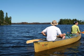
We were anticipating the traditional site we stay at on Little Sag would be closed because of the Cavity lake fire but we weren't sure. So we decided to tour the lake a bit to check on that site and scope out the other options. We paddled north, up the west side of the lake checking out sites along the way. We found a really cool looking one on an island but decided to go check out the traditional site before making our final decision.

As we paddled up the lake we started seeing signs of the fire along the northeast side of the lake. Lots of blackened and brown trees right down to the shoreline. There were a few small clusters of trees right next to the lake that the fire skipped but generally speaking everything was burned even the big towering white pines had burned.

We went over to the northern-most site on the eastern shore of the lake which was pretty much in the center of the burned section of shoreline. We didn't get out of the canoes but paddled right up to the site. Pretty much everything had burned even the pine needles and leaves on the ground.

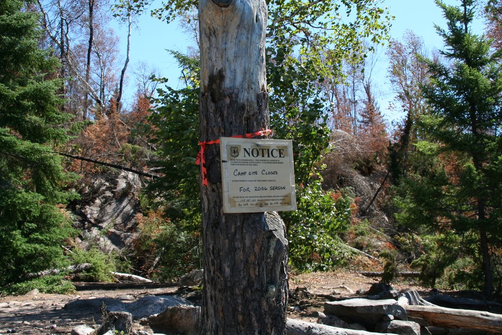
We turned south toward the site we usually stay at and decided to have lunch there. It's kind of a sheltered site below a rock cliff, the fire had burned to the edge of the cliff but hadn't managed to get down into the lower part of the site. There was a sign on a tree in the site that said the site was closed for the remainder of the summer.

There's a trail that leads from the site up to the top of the cliff so I went up there to see what it looked like. Along the trail I could see lots of boot prints and cut trees and stuff, I'm sure these were left behind by the firefighters. It was fairly apparent that they had worked hard to prevent the fire from burning down into the campsite itself.

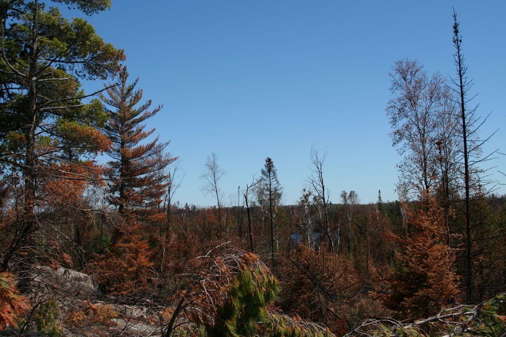
Once on top of the cliff I could see a long way to the east, at least a mile, everything that direction was burned, almost no green at all.

From up there I could also look to the northwest shore of Little Sag and see where the fire had stopped. There was a line extending north away from the lake, brown on one side and green on the other.

South of the campsite it was burned as far as I could see but that wasn't very far.

I was impressed and disappointed at how severe the damage was. A lot of pictures I had seen while the fire was actually burning showed a very patchy burn pattern that was sparing lots of trees. I was also under the impression that the fire had been running out of steam by the time it had gotten to Little Sag, it rained a few times and the wind was favorable (from the SW) at that time but apparently there was enough fuel in the area to keep the fire burning pretty hot despite the conditions.

I'm sure there will be lots of green ground cover right away next Spring, but it's going to be a long time before that part of the lake has any substantial trees living on it. If you look at the lake as the face of a clock with north being 12 the fire consumed the majority of land between 11 and 4.

We ate lunch down on the rocky area right next to the lake.

After that we decided to paddle back into the wind across the lake to that cool island campsite we had seen earlier. A Forest Service Beaver flew right over us as we were getting close to the site, we watched it for a minute and then as we resumed paddling we noticed that while we had been exploring and eating someone had snuck in and stolen the island site from us. It figures, we'd gone most of two days without seeing anyone and when we do they were in our campsite.

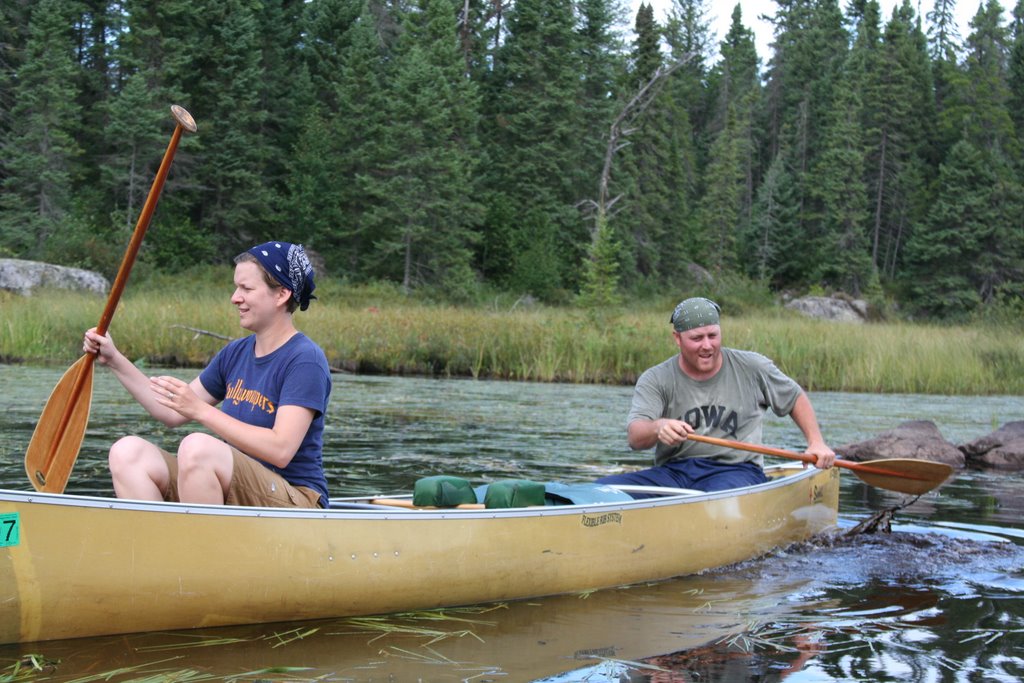
We checked out a few more sites before selecting one down in the southeast corner of the lake. Rob was very determined to find a site exposed to the wind so that we wouldn't have to worry about bugs and this one worked pretty well until the wind died at sunset. But even then the bugs weren't too bad.

There was an airplane that flew by about twice an hour for most of the afternoon, it was a blue and white twin engine thing and appeared to be flying around the perimeter of the fire. I suspect they were using infrared equipment to look for hot spots. Later a helicopter flew up the northeast shore just at treetop level. And occasionally a Beaver would fly over too.

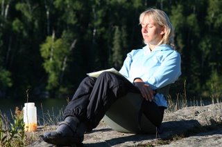
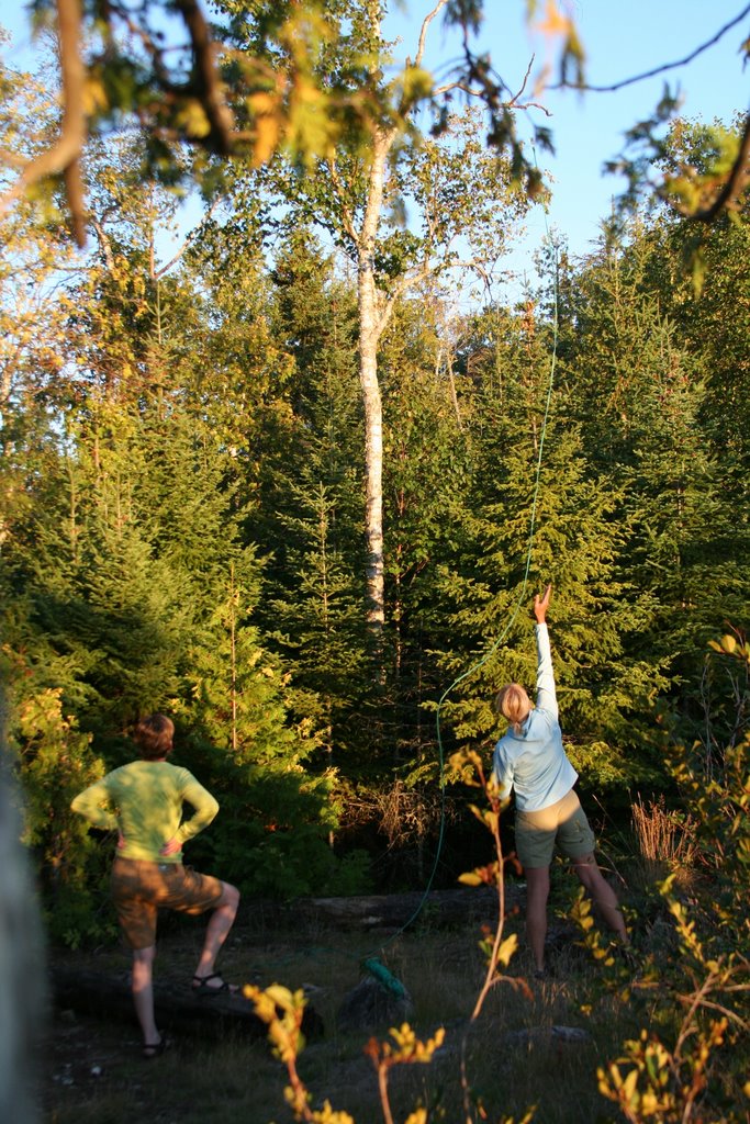
After camp was set up we all went for a swim, even Sandy this time. Then there was a long period of napping and relaxing. I eventually started making dinner and Sandy and Carrie got up and began hanging the bear pack.

This site may have been good for avoiding bugs but there weren't many good choices for hanging the food pack. Eventually Rob got involved and got the rope stuck in the tree we were trying to use. Once dinner was ready I started helping with the food pack too, it was starting to get dark so there was some sense of urgency. We eventually got the rope unstuck and then finally got it over a good branch. It was a pain to get set up but it would've taken a bear on stilts to get our food that night.

After we got the ropes up we ate our Tuna Helper which was still remarkably warm. It was quite dark by the time we were done eating and cleaning up so Sandy got out her constellation chart and we all spent 45 minutes looking at the sky.

Monday, September 11, 2006

Monday, day two.
The sky was clear in the morning so the first thing everyone did was hang up their wet stuff from the day before, we actually got most of our stuff mostly dry by the time we had to pack up. While that was going on I made breakfast which consisted of english muffin sandwiches (eggs cheese and canadian bacon) they took a while to make but were tasty and we weren't in a hurry.

Rob was amused by Lucy's habit of taking the shortest path to the lake to get a drink because it involved going straight down the "cliff" we were on. Then she'd wade out chest deep in the water to get a drink, she's always had her own way of doing things.

Once everything was packed up and in the canoes we set off, one canoe to the west and one to the East. We regrouped for a second, looked at the maps and decided East was the more efficient way to go.

There was a strong steady wind from the southwest and as we paddled through the center of Malberg it was right at our backs. As you head that direction (northeast) toward the portage the lake the lake constricts down to a very narrow spot and then widens out to a long channel up to the portage. As we approached the narrow spot the wind was getting funneled in by the shoreline making it blow harder and harder as we got closer to the bottleneck. It was a pretty cool effect, as we went through the narrowest spot it was almost like being a cork getting shot out of a champagne bottle.

Travel was pretty uneventful, we might have run into one party coming the other direction but I can't remember for sure. We did portage through a section of blowdown from the July '99 straight line wind. It was pretty dramatic, even carrying a canoe I could see lots of downed trees, there were very few left that had trunks over 5-6" in diameter.

Our objective for the day was to get to Makwa. It's a lake I like a lot, it's deep, has lake trout, is far enough in that you don't see many hosers there and has a really awesome campsite. We got the good campsite which is on a big rock outcrop on the western side of the lake. There's a huge cliff that tapers up from the site until it's about 45' straight down to the water, it's scary to stand up there and look down but it's an awesome view out to the east. Down on the site itself the water is really deep right off the rock so you can jump right and swim without having to worry about hitting the bottom or a log or anything.

Once we set up camp and had some lunch Sandy, Carrie and Rob were laying in the sun on the rock near the water. I decided I was going to go for a swim and took a running jump off the rock into the water hoping to surprise and splash the three sunbathers. They were surprised, but the splashing was a total failure. Eventually Rob and Carrie joined me in the lake, Rob was kind of a chicken about it. It took him about 5 minutes to work up the courage to get in, it was almost like when he was in 3rd grade and couldn't get into the pool very fast. Sandy spent the time taking pictures and enjoying the sun.

Later in the afternoon I hiked up to the big cliff to see the sights, I found a big white pine high up on the hillside (not right on the cliff) and climbed 25' or so up that. I was hoping that the combination of the hill and the tree would get me high enough to see up to Little Sag. I was hoping to get a preview of the fire damage in that area. I could see a long ways but not that far, mostly I just got a lot of pine sap on my hands.

I went back to camp and gathered everyone up Rob was taking a nap in the tent and had apparently slipped into a coma. After Carrie went in and revived him we all went up to the cliff to take a look at the view. The sun was beginning to set and was illuminating the trees on the East side of the lake nicely.

Rob and I were on our own for dinner since Sandy and Carrie were having some vegetarian thing. We had some Betty Crocker cheesy potatos to which we added some diced ham, it was ok but not awesome.

Sunday, September 10, 2006

Sunday, the canoe trip begins:
Sometime around 4AM it started raining on us. I know the approximate time because we had left the fly partly off the tent (so we could see out the windows) and I had to run out in my underwear to pull it down. (The rainfly, not my underwear.)

By 7AM it was raining hard. We decided the best course of action was to throw everything in the car and get back up to Sawbill but quick. We threw the disassembled tents on the roof since they were so wet and crammed everything else in and were soon back at Sawbill.
Here's a picture of the ride up to Sawbill:


The workshop was open and unoccupied so we went in there to repack everything which worked out well. I lectured everyone to watch out for people (Bill Hansen) trying to put random objects into our packs but the rain seemed to keep the snoosers away.


After some visiting with Bill and Cindy and checking on the weather everything went back in the car, canoes went on the roof, we made one last swing through the store for breakfast (Egekvist donuts and OJ) and we were off to Kawishiwi.

The drive was uneventful, we unloaded on the landing, took the traditional pre-trip team photo
and hit the water.
Our goal was to get to Malberg for the first night and then figure out where to go next.
The water was extremely low, I've never seen it so low. In the boggy areas going north out of Kawishiwi we were practically dragging on the bottom all the time and most of the portages were extended because you couldn'’t paddle all the way to the normal portage.

To make matters worse after about 3 or 4 portages we caught up with a group of four canoes and 9 dingdongs that we couldn'’t get around for a while. They were very slow getting across the portages and in the narrow channels we were in we couldn't pass them on the water. Once we got to a bigger lake we zipped right around them and then met up with another group of 9 on the next portage. They weren't as annoying and let us go right around them, although they did do some kind of weird chant before launching from the portage.

I thought maybe we should develop our own team chant, and Rob had a great suggestion unfortunately it's far too profanity ridden to print here. If you'd like to hear it sometime let me know and I'll recite it for you. For some reason Carrie and Sandy didn't seem to think we were the kind of group that needed a chant so we dropped the topic. After we got north of Polly lake we didn't seem to see many people anyway so it would have only been wildlife that would have been able to enjoy our chant.

On the portage into Malberg we stopped and walked around the river that's usually flowing along the portage, it turns out the water was so low there were only a few puddles in the riverbed. I've never seen it like that.

Eventually we moved on toward the campsite we wanted, a high rocky site overlooking a narrow channel just west of the center of Malberg. As we paddled up to the site in the rain an otter was checking us out. He'd dive and then come back up periodically to do his little sneezing thing at us. We set up camp and made spaghetti for dinner.

We hadn't really made up our minds where to go from this point so I suggested some options and then left the other three to work it out. The final decision was that we would go up to Little Saganaga and then back to Sawbill.