This was going to be our shortest day, Makwa to Little Saganaga so no one was in much of a hurry. We had oatmeal for breakfast and then lazed around for a while before beginning a leisurely process of packing up our equipment.

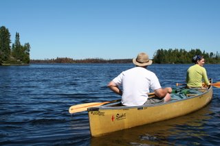
We were anticipating the traditional site we stay at on Little Sag would be closed because of the Cavity lake fire but we weren't sure. So we decided to tour the lake a bit to check on that site and scope out the other options. We paddled north, up the west side of the lake checking out sites along the way. We found a really cool looking one on an island but decided to go check out the traditional site before making our final decision.

As we paddled up the lake we started seeing signs of the fire along the northeast side of the lake. Lots of blackened and brown trees right down to the shoreline. There were a few small clusters of trees right next to the lake that the fire skipped but generally speaking everything was burned even the big towering white pines had burned.
We went over to the northern-most site on the eastern shore of the lake which was pretty much in the center of the burned section of shoreline. We didn't get out of the canoes but paddled right up to the site. Pretty much everything had burned even the pine needles and leaves on the ground.

We turned south toward the site we usually stay at and decided to have lunch there. It's kind of a sheltered site below a rock cliff, the fire had burned to the edge of the cliff but hadn't managed to get down into the lower part of the site. There was a sign on a tree in the site that said the site was closed for the remainder of the summer.

There's a trail that leads from the site up to the top of the cliff so I went up there to see what it looked like. Along the trail I could see lots of boot prints and cut trees and stuff, I'm sure these were left behind by the firefighters. It was fairly apparent that they had worked hard to prevent the fire from burning down into the campsite itself.
Once on top of the cliff I could see a long way to the east, at least a mile, everything that direction was burned, almost no green at all.

From up there I could also look to the northwest shore of Little Sag and see where the fire had stopped. There was a line extending north away from the lake, brown on one side and green on the other.

South of the campsite it was burned as far as I could see but that wasn't very far.

I was impressed and disappointed at how severe the damage was. A lot of pictures I had seen while the fire was actually burning showed a very patchy burn pattern that was sparing lots of trees. I was also under the impression that the fire had been running out of steam by the time it had gotten to Little Sag, it rained a few times and the wind was favorable (from the SW) at that time but apparently there was enough fuel in the area to keep the fire burning pretty hot despite the conditions.
I'm sure there will be lots of green ground cover right away next Spring, but it's going to be a long time before that part of the lake has any substantial trees living on it. If you look at the lake as the face of a clock with north being 12 the fire consumed the majority of land between 11 and 4.
We ate lunch down on the rocky area right next to the lake.

After that we decided to paddle back into the wind across the lake to that cool island campsite we had seen earlier. A Forest Service Beaver flew right over us as we were getting close to the site, we watched it for a minute and then as we resumed paddling we noticed that while we had been exploring and eating someone had snuck in and stolen the island site from us. It figures, we'd gone most of two days without seeing anyone and when we do they were in our campsite.
We checked out a few more sites before selecting one down in the southeast corner of the lake. Rob was very determined to find a site exposed to the wind so that we wouldn't have to worry about bugs and this one worked pretty well until the wind died at sunset. But even then the bugs weren't too bad.
There was an airplane that flew by about twice an hour for most of the afternoon, it was a blue and white twin engine thing and appeared to be flying around the perimeter of the fire. I suspect they were using infrared equipment to look for hot spots. Later a helicopter flew up the northeast shore just at treetop level. And occasionally a Beaver would fly over too.
After camp was set up we all went for a swim, even Sandy this time. Then there was a long period of napping and relaxing. I eventually started making dinner and Sandy and Carrie got up and began hanging the bear pack.

This site may have been good for avoiding bugs but there weren't many good choices for hanging the food pack. Eventually Rob got involved and got the rope stuck in the tree we were trying to use. Once dinner was ready I started helping with the food pack too, it was starting to get dark so there was some sense of urgency. We eventually got the rope unstuck and then finally got it over a good branch. It was a pain to get set up but it would've taken a bear on stilts to get our food that night.

After we got the ropes up we ate our Tuna Helper which was still remarkably warm. It was quite dark by the time we were done eating and cleaning up so Sandy got out her constellation chart and we all spent 45 minutes looking at the sky.
2 comments:
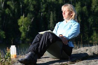
Two questions: was that bear on stilts outside your tent or Rob's? Also...what the heck is up with Sandy in that first photo?
p.s. loving your narrative of the last several days. It so makes me wish I could do another trip up there!
I think Sandy's sitting in a Crazy Creek chair in that photo. Not just balancing on her butt. I don't think she's quite that talented.
Post a Comment